- About
- Affiliates
- Join
- Publications
- Estuaries and Coasts
- CERF's Up! Quarterly Bulletin
- Coastal & Estuarine Science News (CESN)
- CERF-Lit
- Advertising
- Programs & Events
- Inclusive Culture
- Communities
Coastal & Estuarine Science News (CESN)The mission of Coastal & Estuarine Science News (CESN) is to highlight the latest research in the journal Estuaries and Coasts that is relevant to environmental managers. It is a free electronic newsletter delivered to subscribers on a bi-monthly basis. Sign up today! 2025 Issue 4Table of ContentsThe Risk of Groundwater Nutrient Export Using GIS and publicly available datasets to identify potential hot spots
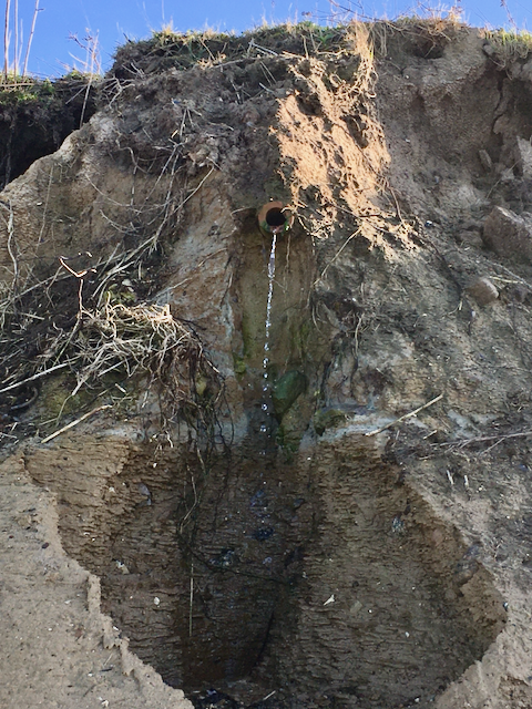
To address this gap, researchers developed a GIS-based method to estimate pollution risks for coastal subcatchments using publicly available datasets. They derived nutrient export risk from hydraulic gradients (change in hydraulic head per unit distance toward the sea), agricultural density (arable land area divided by subcatchment area), and subsoil saturated hydraulic conductivity (a measure of how easily water can flow through a saturated porous material like soil). They then applied their spatial risk mapping approach to identify subcatchments in Germany’s Mecklenburg-Western Pomerania that are at risk of subsurface nutrient export from agricultural activity into the Baltic Sea. They found that nutrient export via subsurface pathways from disconnected catchments is a potentially important yet often overlooked contributor to nutrient fluxes. Except for one subcatchment in the east with exceptionally high hydraulic gradients, subsurface dissolved nutrient export risk was higher in the western coastal subcatchments. Traditional assessments focused solely on surface fluxes can significantly underestimate total nutrient loads, but groundwater nutrient discharge monitoring programs are very costly. The approach taken here, which utilized existing geospatial databases, can help identify and prioritize high-risk coastal catchments where further investigations are needed—allowing for more efficient resource allocation to mitigate nutrient pollution from less visible sources. Source: Ahmad, S. et al. 2025. Land Meets Sea: Towards the Development and Application of an Indicator to Assess Subsurface Nutrient Export Risk from Disconnected Coastal Catchments to the Sea. Estuaries and Coasts. DOI: 10.1007/s12237-025-01542-z Image: A tile pipe draining an agricultural field ending at a cliff over the southern Baltic Sea / Bernd Lennartz Passive Samplers Can Detect Emerging Harmful Algae Threats Several phycotoxins have been detected in New Jersey for the first time
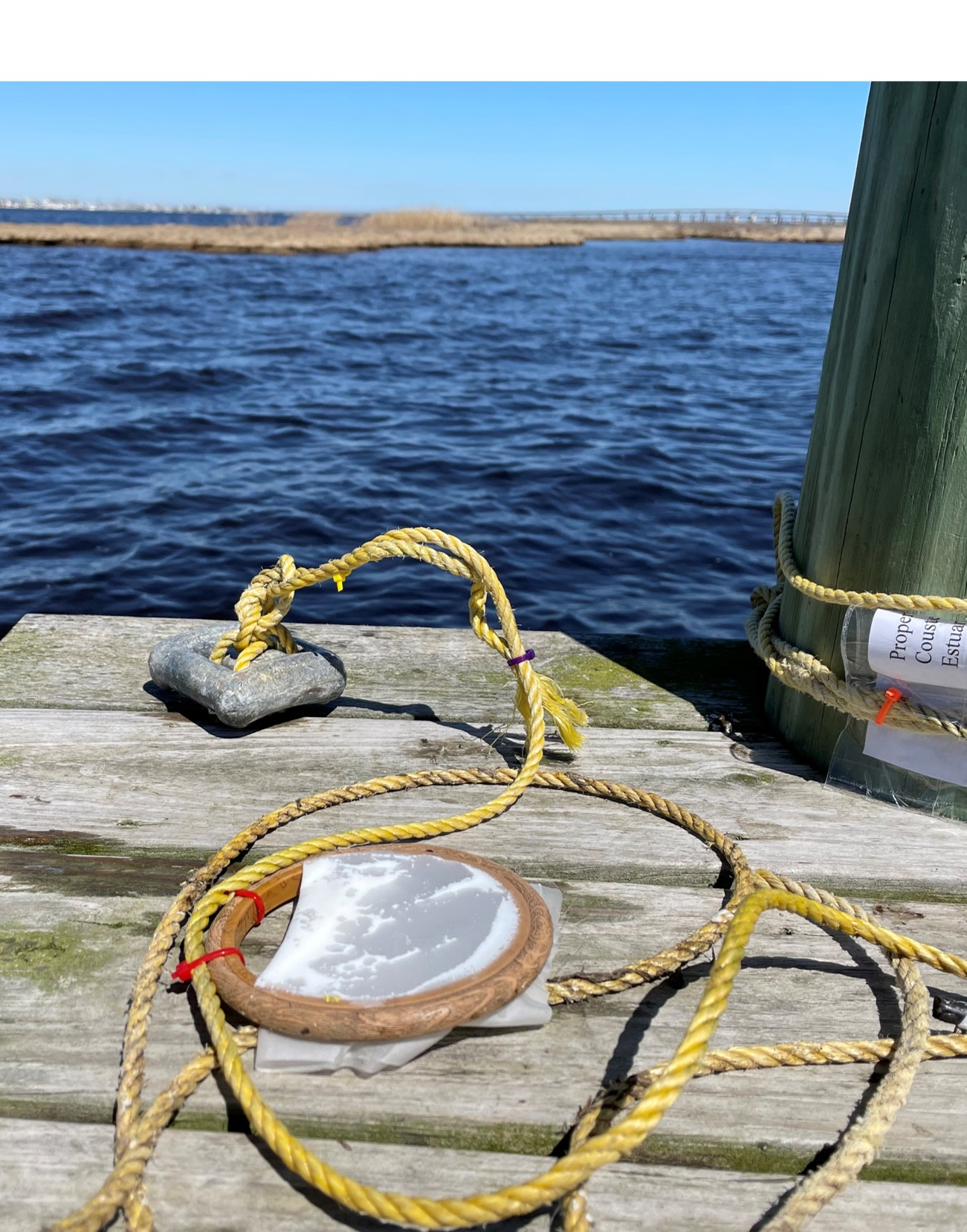
In New Jersey, researchers wanted to determine whether passive sampling via solid phase adsorption toxin tracking (SPATT) can be successfully used to detect phycotoxins in areas with high levels of natural plant chemicals like phenolics that might interfere with the analysis. Small mesh bags filled with porous synthetic resin were suspended in the water column and sampled monthly from spring to fall over three years in two estuaries: Mullica River-Great Bay and Toms River-Barnegat Bay. Seven important phycotoxins were detected in the SPATT bags. These included yessotoxin, which has caused significant shellfish mortality in many locations around the world but hadn’t previously been recorded on the east coast, and three other phycotoxins that hadn’t been recorded this far north. However, the presence of phenolic compounds in the watershed did interfere with detecting certain phycotoxins (like microcystins) on SPATT bags by competing for binding sites on the resin, suggesting that the efficacy of passive samplers may be compromised in areas with high phenolic content. Most state monitoring programs rely on microscopy to enumerate species of concern. Taxonomic identification is labor intensive, and species presence doesn’t necessarily equate with toxicity. Moreover, that only represents a single snapshot of the conditions, whereas SPATT bags offer extended deployments and cumulative sampling. Ultimately, because SPATT bags measure dissolved toxin levels, they still can’t replace direct sampling for quantifying phycotoxin levels in shellfish tissue. But when deployed alongside other tools, SPATT bags can be an effective and important complement for detecting and monitoring phycotoxins in estuaries. Providing a more complete assessment (and warning) of emerging HAB threats is especially critical with potential shifts in the geographical range of harmful algae as a result of climate change. Source: Armstrong, C.T. et al. 2025. Phycotoxins Along Two New Jersey Estuaries—Limitations of Passive Samplers in a Complex System. Estuaries and Coasts. DOI: 10.1007/s12237-025-01536-x Image: Passive samplers deployed in New Jersey / Taylor Armstrong Plastic Pollution in Kenyan Mangrove Forests Why isn’t a ban on single-use plastics working? 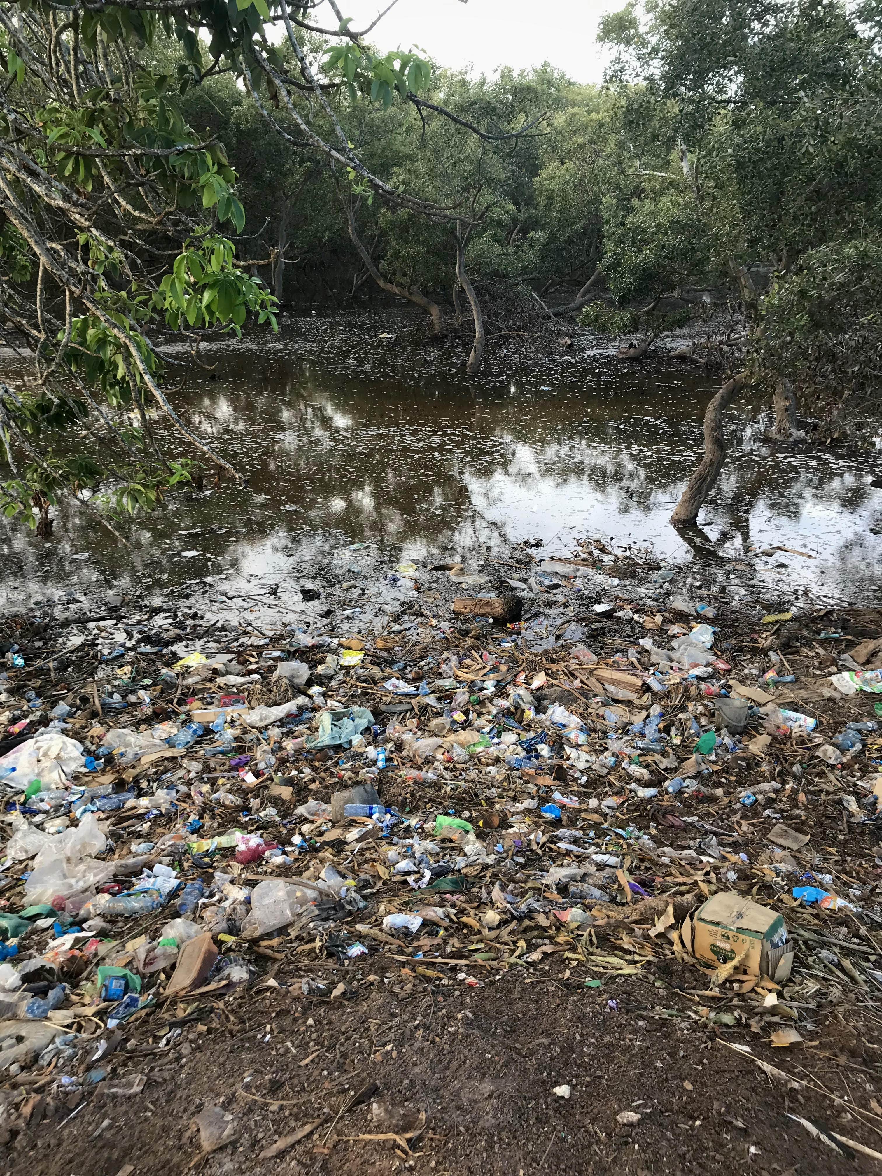 Less than five millimeters in size, microplastics can easily disperse across various ecosystems, including estuaries where they become trapped in the complex root systems of mangrove forests. In Kenya, single-use polyethylene bags have been banned since 2017, but enforcement is inconsistent and compliance is difficult. To better understand the sources of plastic pollution and the human behaviors that drive it, researchers devised a dual-study approach that integrates field sampling with interviews in Gazi Bay on the south coast of Kenya. To characterize the sources and spread of plastic debris, the team collected plastic samples and mapped their distribution across the mangrove forest and adjacent beach areas. They then interviewed 60 households in nearby Gazi village to better understand the plastic use and disposal habits of residents and fishermen, as well as their knowledge and perceptions of plastic pollution and local waste management. Although they recovered few single-use bags, indicating that the ban had positive impacts, the team found that plastic pollution is still widespread. Ropes, fishnets, and other fishing related plastics were prevalent in the seaward zones, whereas domestic waste (such as bread wrappers, slippers, and food containers) was the primary land-based plastic source. More than half of the survey respondents admitted to littering, yet at the same time, 90% expressed willingness to reduce plastic waste if there were better access to recycling and improvements in local waste management. These findings demonstrated the value of pairing a source identification study with a social science survey to characterize both the extent of a local plastic pollution problem as well as the societal attitudes and behaviors shaping the problem. Although identifying the spread of plastic pollution is important for targeted policies and localized mitigation strategies, it’s also crucial to understand the underlying economic constraints and social drivers that shape plastic accumulation. The authors suggest involving local communities in co-designing socially and economically feasible waste management programs to help improve compliance and long-term effectiveness. Source: Pelsmaekers, E.P.B. et al. 2025. Assessing Plastic Pollution in Kenyan Mangroves: Distribution, Sources, and Social Impact in Gazi Bay. Estuaries and Coasts. DOI: 10.1007/s12237-025-01573-6 Image: Main village waste disposal site adjacent to Avicennia-dominated mangroves / Elissa Pelsmaekers Underwater Noise Travels into Protected Areas Too Noise pollution could harm marine animals where we don’t expect it
To better understand potential acoustic threats to marine species, researchers placed hydrophones within Port Stephens Great Lakes Marine Park in New South Wales. The park is divided into “no-take” conservation zones that prohibit the removal of any marine species and “open” multi-use zones, which allow a range of activities, including fishing, boating, seabed mining, and soon, offshore renewables like wind. The team recorded underwater sounds at three inshore (estuarine) sites and two offshore sites in the park. In each case, they paired no-take and open locations. A total of 1,150 hours of sounds were recorded across two consecutive weeks between April and May 2023, then teased apart by humans and AI. Even though more anthropogenic sound was generated in the open zones, there was only a minor difference of less than 3 dB in underwater sound levels between no-take and open zones—with boat sounds being the main contributor. Additionally, the variability in sound levels and frequencies was not consistent from the inshore to offshore sites or in the conservation to multi-use zones. These findings indicate that sound crosses management boundaries, and areas that allow human uses generate sound that impacts adjacent conservation zones. Underwater sound travels very long distances, and in addition to the effects of harvesting, direct disturbance, and contamination, management plans and MPA siting need to take into account the potential impacts of acoustic threats on marine species. Source: Valenzisi, B. et al. 2025. Underwater Soundscapes of Management Zones and Potential Impacts on Marine Communities. Estuaries and Coasts. DOI: 10.1007/s12237-025-01554-9 Image: hydrophone / Brittney Valenzisi |