- About
- Affiliates
- Join
- Publications
- Estuaries and Coasts
- CERF's Up! Quarterly Bulletin
- Coastal & Estuarine Science News (CESN)
- CERF-Lit
- Advertising
- Programs & Events
- Inclusive Culture
- Communities
Coastal & Estuarine Science News (CESN)The mission of Coastal & Estuarine Science News (CESN) is to highlight the latest research in the journal Estuaries and Coasts that is relevant to environmental managers. It is a free electronic newsletter delivered to subscribers bi-monthly. Sign up today! 2026 Issue 5Table of Contents
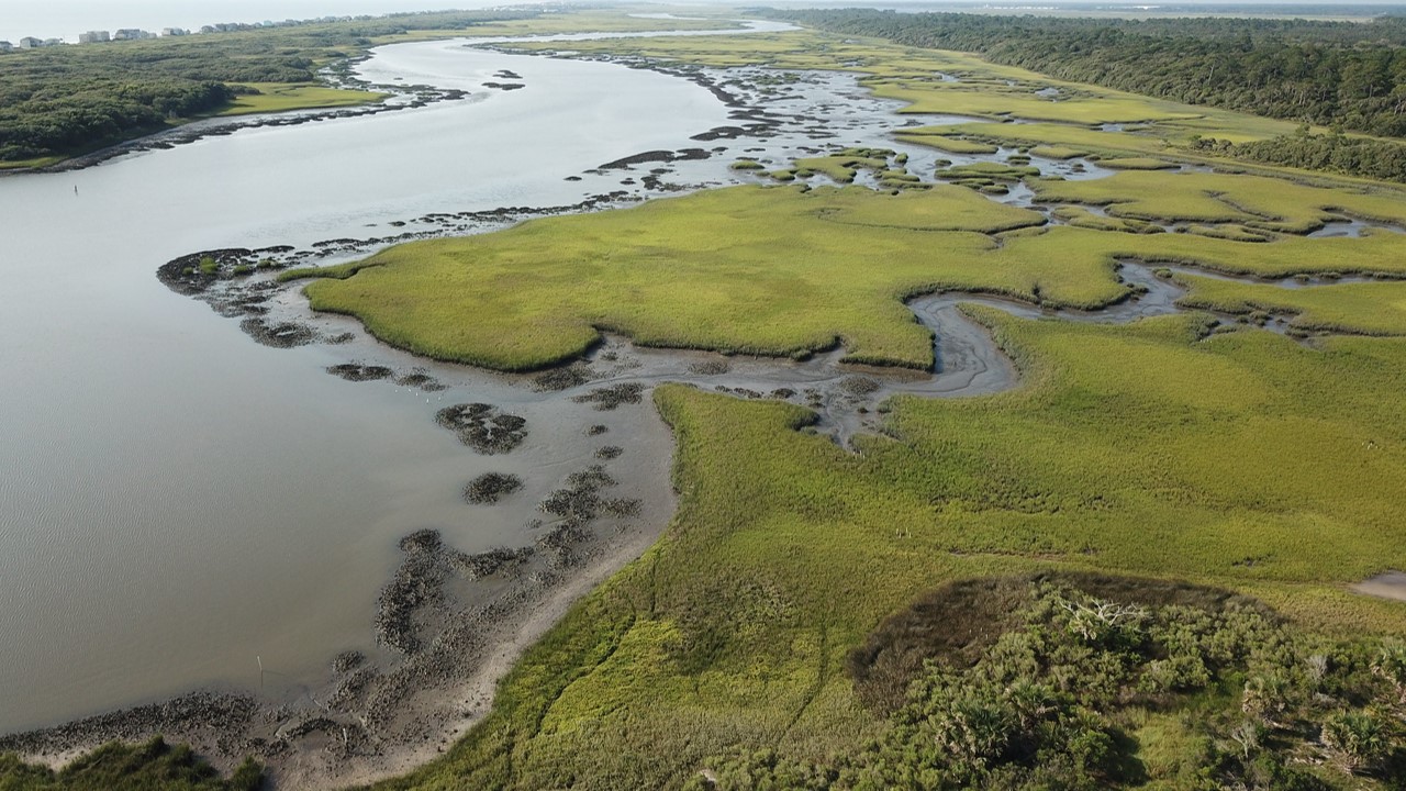
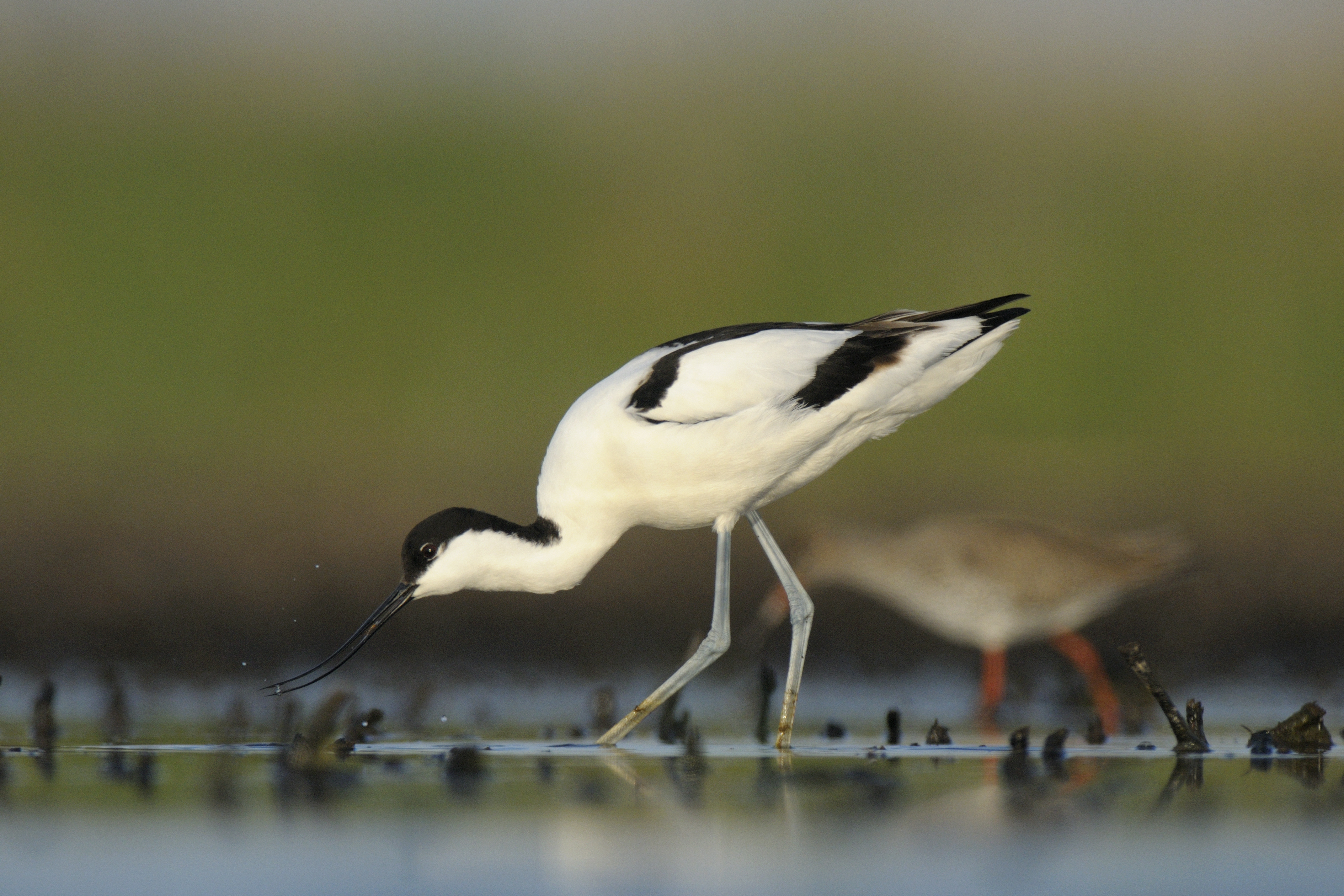
Predicting Wetland Migration with Sea–Level Rise Is there enough accommodation space along the Texas coast? Over the coming decades, more and more low-lying coastal wetlands are expected to become submerged as the result of sea–level rise (SLR). Managers can potentially offset losses by promoting the migration of wetlands to adjacent areas at higher elevations. To inform decisions about where and how to intervene, managers need to predict which wetlands will be affected. A team of researchers developed a wetland change model that incorporates recent literature on coastal wetland drowning thresholds as well as uncertainly in both elevation data and in current and future water levels. They used the model to project how wetlands and adjacent upslope lands would shift through 2100 for the middle and upper Texas coast under three future relative SLR scenarios. Their elevation-based model showed how different wetland areas will be affected differently by SLR. Low-lying, gently sloped Sabine Lake on the upper coast has ample room to migrate naturally to upper areas, although submergence is increasingly expected to outpace that migration; the steeper Aransas Bay on the middle coast has less migration space overall, but it is expected to benefit from migration rates that exceed those of submergence. Although there is opportunity for these wetlands to migrate landward, this would occur at the expense of existing freshwater wetlands and, to a lesser extent, different land uses occupying adjacent upland areas including pastures, rice farms, forests, and grasslands—underscoring the tradeoffs associated with promoting this strategy. The model gives managers a scalable tool for identifying where and when wetland migration is likely to keep pace with (or fall behind) submergence. This information can guide decisions about protecting existing wetlands or prioritizing migration by removing barriers such as levees and human development. Source: Enwright, N.M. et al. 2026. Incorporating Wetland Drowning Thresholds to Assess the Spatiotemporal Variability in Potential Wetland Migration and Submergence From Sea-Level Rise. Estuaries and Coasts. DOI: 10.1007/s12237-026-01752-z Image: Texas wetlands with marshes dominated by succulent plants / Jena Moon, USFWS Working Together on Eutrophication Targets A co-production case study from an urbanizing estuary in Florida When it comes to managing eutrophication in estuaries, it can be difficult to pinpoint which of the many different pollution sources across various jurisdictions to target and prioritize. And scientific data often fail to inform management decisions because of the lack of stakeholder engagement. A team of researchers in Florida used a five-phase co-production framework to design a practical management plan that they applied in the Guana River Estuary, which exceeds water quality standards for chlorophyll a. The phases are identify, understand, assess, evaluate, and develop: identify stakeholders, relevant available data, and potential mitigation actions; understand what type of information would be actionable by various stakeholder groups; assess potential mitigation actions through scientific research aimed at addressing stakeholder questions; evaluate management actions and research needs based on analyzed data and stakeholder input; and develop approaches for communicating and facilitating the implementation of the recommendations. Their approach led to three recommendations that addressed research needs and six management-focused recommendations that offer actionable strategies. These include developing a calibrated watershed model, investing in nutrient loading and discharge monitoring, characterizing organic nitrogen sources, avoiding actions that alter salinity, supporting shellfish ecosystem services, and sustaining engagement and communication created in the co-production process. This framework helps convert new and existing data into management actions andlays out a strategy for getting community support for those actions. It also highlights non-traditional knowledge about factors controlling eutrophication and the consequences of excess nutrients to community well-being.The authors suggest their approach would be broadly applicable in other estuaries facing similar challenges. Source: Fischman, H.S. et al. 2026. A Collaborative Framework for Producing Science and Management Recommendations to Restore Water Quality: A Case Study from the Guana Estuary, Florida. Estuaries and Coasts. DOI: 10.1007/s12237-026-01738-x Image: Guana River Estuary / Allix North How River Flow Impacts Estuarine Ecosystems Assessing the effects of upstream water use and climate change in northern Australia Freshwater flow is essential for healthy estuaries, which provide critical habitat for many economically valuable fish and crustaceans as well as threatened and endangered species. But in tropical areas with strong wet and dry seasons, the volume and timing of changes in river flow affect species that rely on both high- and low-level flows at critical times throughout the year. Researchers in northern Australia wanted to better understand the downstream consequences of altering natural river flows. The team used an intermediate complexity ecosystem model to quantify the impacts that dams, water extraction, and groundwater harvest, as well as future climate change, will have on the common banana prawn, barramundi, giant mud crab, largetooth sawfish, mangroves, and seagrass downstream in the Roper River. All populations of fish, shellfish, seagrasses, and mangroves were affected by altered flows, with sawfish and mangroves being particularly sensitive. The relationship between the species’ responses to changing water availability was largely non-linear. The greatest impact was due to water extraction, followed by the impoundment of water behind dams; however, reduced river flows caused by future climate change had more deleterious effects than human water use alone. Water resource management must be tailored to the timing and water patterns of the rivers feeding the estuaries, and actions should be seasonally adapted: The authors recommend avoiding extraction during the dry season and early wet season. Their modeling also demonstrated that negative impacts of modifying flows can be substantially reduced by setting threshold values for both river flow levels (below which water cannot be extracted) and end-of-system flow volumes (until which flows cannot be modified). Doing so could support agriculture irrigation while mitigating impact on downstream ecosystems. Source: Kenyon, R.A. et al. 2026. Environmental Flows Should Be Climate-Adapted and Can Reduce Downstream Impacts of River Flow Modification. Estuaries and Coasts. DOI: doi.org/10.1007/s12237-026-01746-x Birds are Rapidly Colonizing Islands of Dredged Sediment But the benefits may be short-lived Colonial waterbirds and shorebirds that nest on the ground rely on open, predator-free areas. But these types of natural pioneer habitats—sandbars, beaches, mudflats, and sparsely vegetated shorelines—are vanishing due to a variety of human pressures. In the last decade, dredged sediments have been used to create artificial islands that function as substitute breeding and foraging habitats for birds. Though promising, the potential for rapid vegetative turnover calls into question their long-term ecological value. The recently created dredge-material islands in Szczecin Lagoon in the southern Baltic presented an opportunity to study colonization dynamics of waterbirds. Researchers monitored bird populations, their predators, and vegetation change on two islands from 2021 to 2025. Both islands consisted of low-relief sandy substrates resembling natural pioneer habitats and lack tides to suppress vegetation establishment. Ground-nesting birds colonized the islands immediately, and the number of breeding species rose from seven to 35 by the end of the study period. Despite their extremely small size, the islands quickly supported a disproportionately large share of the region’s breeding populations of several rare and scarce species: They became Poland’s only relatively permanent breeding site for the Pied Avocet and boasted the nation’s first confirmed breeding record for the Caspian Tern. However, vegetative succession also progressed rapidly, with total vegetation cover reaching nearly 50%. The researchers estimate that without intervention, the availability of open ground for nesting would largely disappear within three years. Newly created dredged-sediment islands can be useful in quickly restoring important breeding habitat for scarce waterbirds, but these conservation gains would be negated without controlling vegetative succession. Furthermore, although no mammal predators were detected, even one mink or fox could destroy all the nests in a colony. Both vegetation control and continuous predator surveillance must be incorporated into the design and long-term management of artificial islands. Source: Marchowski, D. et al. 2026. Dredged-Sediment Islands as Temporary Ecological Refugia: Rapid Waterbird Colonisation and Fast Habitat Closure in a Baltic Lagoon. Estuaries and Coasts. DOI: 10.1007/s12237-026-01737-y Image: Pied Avocets / Miłosz Kowalewski |